|
Spence Air
Base Today
Pictures
and
comments below contributed by
Ray Sack of Class 60-E
|
|
SPENCE (MUL)
UNICOM: 123.00
4 MILES SE OF MOULTRIE
COORDINATES: N31-08.26
W083-42.24
ELEVATION:
292
ft.MSL
RUNWAY: 14/32 concrete
4500
X 75ft.
OBSTRUCTIONS: FARM
& CONSTRUCTION
EQUIPMENT, PHONE
POLES, AND BIRDS IN
THE VICINITY
|
For many years, I
have
wanted to re-visit
Spence Field. There was always a
compelling feeling to
return. The opportunity never arose until
March 2005. My
wife and I were returning from a trip to
Florida. I found myself
driving north on I-75 (eventually heading for
the Augusta, GA area) and
realized that I would pass within a few miles of
Moultrie, GA and
Spence Field. With tongue in cheek, I like
to say that as I
approached the exit to Moultrie the car went
into automatic pilot and
headed for Spence. As we approached the
old airbase, I spotted
the water tower from the highway and knew
exactly where I was. A
turn from highway 133 put me through the main
gate. …and after
forty-six years, this is what I saw. My
descriptions reflect the
base layout as I remember it from 1959 (Class
60-E). I also have
a copy of the
Base
Layout
that greatly enhanced my memory for
street names, buildings,
and directions.
|
|
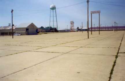
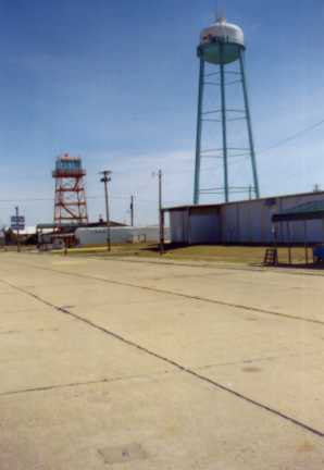
(Left) The water tower and
control tower
are two prominent landmarks
that remain. The water tower no longer
sports it's
distinctive red and white checkerboard
pattern.
(Above) The view is from the T-28 ramp area
that is now cluttered with
light poles that are used for agricultural
equipment shows.
I couldn’t help being amused by the thought
that as cadets we thought
the big radial engines in the T-28s sounded
like John Deere
tractors.
I suppose that sound lingers on.
|
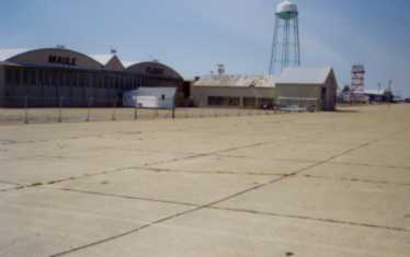
(Right) The large hangars also remain as
prominent landmarks.
This one has found new life as a facility for
a specialty aircraft
company. Buildings and fences limit
access to many areas on the
old aircraft tie-down area. This view is
from the T-28 ramp area
looking towards the east hangar (Hanger
3). What is most striking
is the empty ramp area where dozens of
aircraft were once parked.
|
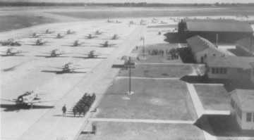
(Left) - The
way it was
--
View from the Control Tower
looking
east. The east hanger (Hangar
3) is farthest building on right.
|
|
This view is looking east from the T-34 ramp
area towards
the middle hangar (Hanger 2). I believe
that Bevo Howard’s
Buecher Jungmeister was frequently parked in
front of this hangar.
|
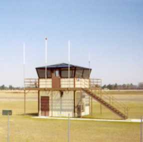
Two small
control towers
are located at either
end of open runway 14/32. Since Spence
is now the auxiliary field
for Moody AFB, I suppose this is today’s
version of Runway Control.
|
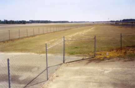
This is the
one remaining
open runway (14/32)
looking southeast. As I recall, this
runway saw a lot of use
during our training days with take-off and
landing often from the
southeast to the northwest. I remember
many touch and go landings
on this runway.
|
|
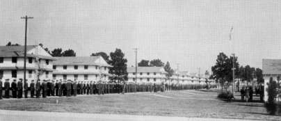
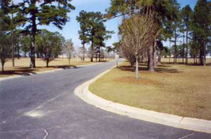
This is the intersection of Carter Avenue and
West Yount Street.
You are looking north up Carter Avenue towards
the flight line.
Two buildings for academics were located to
the right side of the
photo. The Aviation Cadet Quarters were
located to the left side
of the photo. All the structures are
gone now and the tree
population has increased.
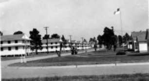
(Below) The way it was --
|
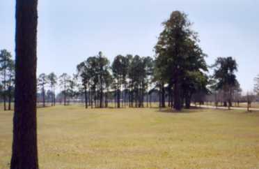
You are
looking south
from Harper Blvd.
Carter Avenue is to the right.
The area beyond the trees on
this side of Carter Avenue was the site of
the Aviation Cadet Club and
Academic Buildings.
|
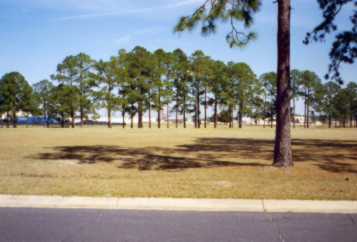
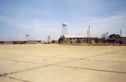
In this view
you are
looking northeast across
Harper Blvd. towards the flight line.
Water Tower and Control
Tower can
be seen through the trees. This view
has probably not changed
much.
|
|